

PS-WebTOPOs Topographical Maps System
Pansophic WebTOPOS is a complete stand alone system for the maintenance of Cyprus Topographical Maps as published by the Government's Land Registry department. It supports old and new maps.
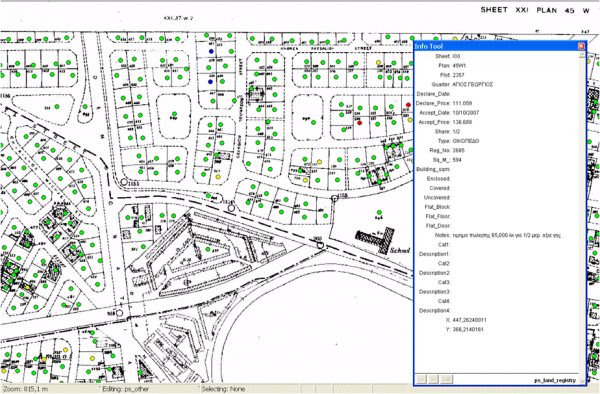
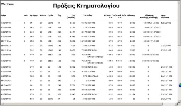
It offers searching of Land Registry sales transactions and past company's Valuations with many criteria.
- Sheet/Plan or Map Code
- District, Town/Village, Quarter
- Valuation Reference
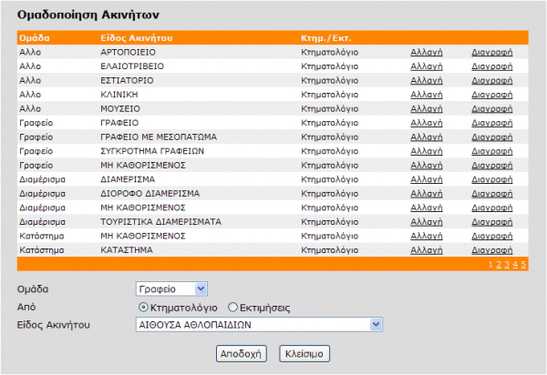
- Property Type
- Property Registration Number, and much more
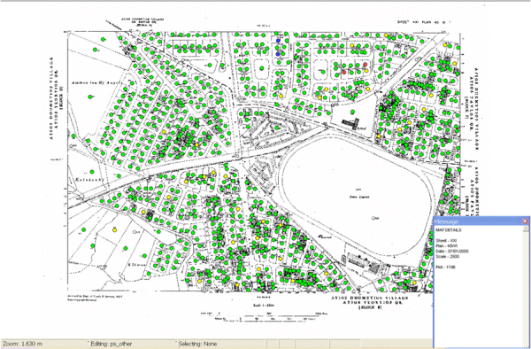
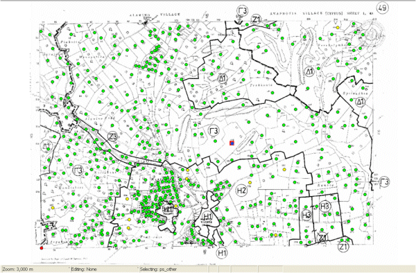
In a matter of seconds display a required topographical map with marked properties based on user selections for further processing and printing. Users can calculated distances, areas, etc. Extensive Map maintenance and production through MapInfo.
Cross reference table allows the relation of properties with old map coding and new map coding (i.e. XXI/45W1 to 2-200-200).
Main system characteristics:
- Operation in Internet / Intranet environment
- More than 7.500 maps in the system
- Support for multiple publication dates for a single map
- Full GIS processing of Maps through MapInfo
- Dynamic Map Creation based on user criteria
- SSL support
- Extensive user security
- Active Directory support
- Extensive parameterization allows configuration based organization requirements
- Optional Interface with WebZones system
Screen Captures
| Technical Information | |
| Operating System | Microsoft Windows Server 2003/2008 |
| Web Server | Microsoft IIS 6, 7, 7.5 |
| Database | Microsoft SQL 2005/2008 |
| GIS | MapInfo |